

Geography and Map
Karalam Grama Panchayat
Geographical Features
Karalam Grama Panchayat
Karalam Grama Panchayat is a Grama Panchayat in Thrissur District of Kerala. It is primarily known as an agriculturally significant region. The geographical features of the Panchayat are given below.
Major Geographical Features
- 01 Karalam Panchayat is located near Irinjalakuda in Thrissur District.
- 02 The terrain of the region is generally flat.
- 03 Wet, cultivable soil is predominantly found here. Paddy cultivation is the main agricultural activity.
- 04 Small and large canals and streams pass through the Panchayat, which are beneficial for irrigation.
- 05 The climate is tropical monsoon in nature; southwest monsoon rainfall is received from June to September.
- 06 Coconut, banana, vegetables, and other crops are also cultivated.
🌾 Agricultural Significance
The flat terrain, wet and cultivable soil, and irrigation facilities provide favourable conditions for agriculture in Karalam. Along with paddy cultivation, various crops such as coconut, banana, and vegetables are also cultivated here.
Karalam Grama Panchayat Ward Map
A static map and the official interactive ward map are provided below to view the ward divisions of Karalam Grama Panchayat.
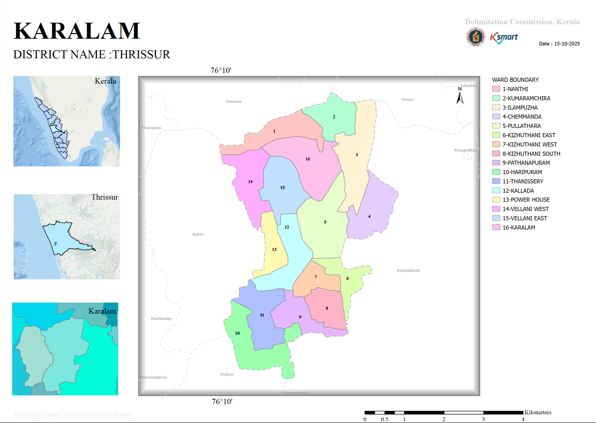
Interactive Ward Map
The interactive map below can be used to examine the wards in greater detail and view various information on the map.
The map is displayed from the official K-SMART Ward Map system.


